Showing posts with label island. Show all posts
Showing posts with label island. Show all posts
Thursday, 20 October 2016
Lizard Island to the top
Saturday 25 – Sunday 26 June.
Even sheltered in Watson’s Bay at Lizard Island we have been experiencing 15 to 25 knots of wind constantly so have left the anchor firmly dug in while we laze around, catch fish and get to know each other a bit more. Each morning and afternoon we tune in to Cairns Volunteer Marine Rescue for the latest weather up date. By now we feel like we are suspended in some sort of groundhog day joke as every broadcast has been identical, strong wind warning – 25 to 30 knots from Torres Straight to Cardwell for the foreseeable future with the additional reminder that wind gusts of up to 40% stronger could occur.
We actually have a deadline to get to Darwin because not only are we supposed to be there by July 9th to allow two clear weeks to arrange our visas and cruising permit with the Indonesian consulate, but also as Colin and Milin have arranged for a new forestay to be fitted in Darwin before we head into Asia. The forestay is 14mm stainless steel cable which not only holds the Genoa (front sail ) on but also holds the mast up so it’s a fairly important part of the boat. With three days already being lost sitting at Lizard Island we are all getting a bit anxious. We know every day at anchor probably means an extra night under sail on the way around the top.
During the course of Sunday afternoon two yachts and a two catamarans arrived from the south and told us that while the winds were strong they were fairly steady and they’d had no problems, hence the decision was made to up anchor first thing in the morning and head Nae Hassle north again.
Monday 27 – Wednesday 29 June
By 7am we had everything secured away and set just a reefed mainsail for the run back towards the mainland and up the coast. With 20 to 25 knots behind us we were quickly rocking and rolling along.

Because of the days lost at Lizard Island we have now put a line through overnight stops at a couple of anchorages on the way up the coast and are pushing on straight through to Mt Adolphous Island just north of the tip of Cape York, a trip of 340 nautical miles. The target is to reach it Wednesday afternoon for a night at anchor before leaving early the next morning. This will ensure we have a favourable tide for the run through Torres Straight where currents are really strong.
North of Cairns the Great Barrier Reef gets closer and closer to the coast. Not only do we weave in and out making our way around the masses of coral reefs but for most of the trip we share the main shipping channel with tankers, bulk carriers and container ships doing the same thing. During daylight hours you quickly realise A. How big they are and how insignificant they make even a 57 foot yacht like Nae Hassle feel, B. How fast they get from the horizon to right on you, C. How much you hope they are keeping as good a lookout as you are, and D. How easy it would be to do a Jessica Watson and get run over.
At night it’s plain scary at times. While we do all we can to skirt along the edges of the shipping lanes wherever we can, winds etc don’t always make this possible. Some ships will call you up on the radio to make sure you’re both aware of each other’s plans, others will make an ever so slight course change just to make their intentions clear while some will just steam on ahead, not answering any radio hails and showing no sign of whether they know you’re there or not. One large container ship passed us port to port about 80 metres away on one of Karen’s night watches. They probably knew we were there but you could never be sure. Forget the old power gives way to sail bit. We just do all we can to stay the hell out of the way.
 |
| The massive boulders of Cape Melville |
We pass by some amazing scenery with numerous small islands, what appears to us to be thousands of reefs and a coastline of contrasting lowlands and ranges. The boulders of Cape Melville in particular are a remarkable feature and we had the added drama of squalls passing through as we sailed by in the late afternoon which formed a dramatic backdrop to this Cape. Karen has definitely marked it down as an oil painting waiting to happen. Cape Melville and the hills to the south are comprised of massive, smooth granite boulders piled on top of each other. Our photographs don’t do the size of these huge marbles justice. Those who wish to climb the rocks are warned in the cruising guide that they are a lot bigger than first impression and of the large number of snakes that inhabit the area.
 |
| The mackerel keep coming. |
We’re continuing to keep the freezer topped up with fish. It certainly gets everyone excited when there’s a good one on the line. Our fellow crew guy, Marc, is a Londoner who had never seen fish as big as we’ve been getting let alone caught one. Karen on the other hand was raised with a filleting knife in her hand growing up in the Whitsundays. We caught a good size spotted mackeral not long after leaving Lizard Island (outside the habitat protection zone of course) but by late on the second day heading up the coast we’d had no luck. I was on the helm with Marc and Karen sitting in the cockpit. Karen decided to head below to get some sleep before her watch and was disappearing down the companion way when Marc commented to her “I was hoping we’d get a fish before you went to sleep so you could show me how to kill it.” At that point I looked behind the boat and said to Marc, “Well why don’t you just pull that one in.” Sure enough, a very good sized tuna had just taken the lure and Marc got his lesson in killing, bleeding, cleaning and turning a big fish into pan ready steaks. Henceforth he has been dubbed “Marc the be-header” by all on board.
Next afternoon we lost a metre long spainish mackerel trying to lift it onto the boat. We don’t have a gaff and had no hope of getting it in the landing net. Half an hour later Rob was pulling in another nice spotted mackerel when a shark decided to make it his dinner and only left us with the head. BUGGER!
After experiencing motoring with no wind to 30+ knots and everything in between we passed by the tip of Cape York and reached Mt Adolphous Island right on schedule at 5.30pm on Wednesday afternoon, just in time to get the anchor down in Blackwood Bay and settle in for sundowner drinks.

Sundowners are of course the obligatory refreshment taken while you sit back and enjoy the sunset. We have not been disappointed with the marvels of the setting sun. As Queenslanders we don’t get to see the sun set over water and the colours the sun turns the sky and water on her way down are mesmerizing .
On the subject of sundowners, we observe a strict no alcohol policy while underway but once the anchor is down or mooring ropes on, there’s nothing better than ending a day with great food, a couple of drinks and good conversation.
Lizard Island to Mt Adolphous Island -340.5 nautical miles – 59.16 hours – 5.75 knot average speed with reefed mainsail only – One tuna – Two Mackerel ( Two more got away)
Wednesday, 22 June 2016
Discovering some limits Island Head Creek to Great Keppel Island
November 28, 2015
We followed our previous day’s track on the chart plotter downstream in the pre-dawn light to clear the mouth of Island Head Creek before the lowest of the tide. We were surrounded by four other boats including our friends on Seabreeze and Howzat clearly with the same idea in mind. Sticking very close to our track made exiting the creek much less stressful than the entry had been. The theory being, if we didn’t hit the bottom anywhere we went yesterday we shouldn’t hit it there today either. We did see some readings in the two metre levels again inside the mouth but successfully cleared Island Head without bouncing off anything. We love a theory that works.
 |
| The sun rising as we depart Island Head Creek |
Again the seas just outside were quite rough and confused and we were very happy that our Leisurefurl in boom mainsail is so easy to raise from the safety of the cockpit. The mizzen can also be reached from the back of the cockpit so with those both raised we soon had the genoa unfurled and set course for Great Keppel Island 60 nautical miles to the south.
 |
| Rick and Howzat disappeared into the distance again in the downwind conditions |
The coastline here is all part of the Australian Defence Force’s Shoalwater Bay Exercise Area and as such is completely uninhabited, unless the Army, Navy or Air Force are there blowing the place up again in which case we cruisers are forced to sail by well offshore. The geology is quite dramatic with many small, rocky islands rising vertically out of the water to quite significant heights. As soon as the sails had been trimmed and the boat was settled on course, Karen had her sketch pad our recreating a number of the more dramatic looking scenes along the way.


The modest wind blowing around ten knots from the Nor Nor East through the morning saw us edge away from the coast to maintain a workable sail angle so progress was comparatively slow. We gybed back and forwards a couple of times but eventually settled on a long run further offshore in attempt to keep the boat speed somewhere near respectable. The breeze was forecast to strengthen later in the day so we were hoping to pick up the pace in the afternoon or we may be arriving at Keppel in the dark.
Well offshore from Cape Manifold we gybed again back towards the coast. The wind was picking up at last but also swinging around for a while before finally settling in the mid to high teens from almost due North. With our destination now almost due South we poled out the genoa on the opposite side to the main and mizzen and began sailing wing on wing directly downwind consistently making better than seven knots.
 |
| Our Dreamtime charging downwind wing on wing approaching North Keppel Island. |
With our sails well filled and Our Dreamtimecharging along nicely as ever bigger swells rolled under our hull it was far from the perfect time to hear the ratchet on our game rod suddenly start screaming . We had hooked a large fish that was reeling line off at a scary rate while it was impossible to even slow down the boat let alone stop and back it up on the fish the way you would on a game boat.
Rob grabbed the rod and progressively increased the drag until the speed at which the line was disappearing slowed to a trickle. The fish managed another couple of decent runs but each time Rob was able to manage and then finally stop the loss of line. Eventually he was able to start retrieving line but whatever it was, this fish was not going to give up easily and would try to run again. The battle ebbed and flowed for a few minutes before the stern of the boat was picked up by a good sized swell which we surfed down the face of at nine knots or so putting too much strain on the line. Goodbye fish and goodbye favourite lure. Bugger. Fresh fish for dinner at Great Keppel Island would have been nice.
Mid afternoon the wind began to strengthen further and by the time we were approaching North Keppel Island we were seeing regular gusts over 20 knots. These conditions began to test Ben & Gerry. (The nick name for our new B&G Autopilot) The big swells often swung the stern which presented much more of the mizzen and main to the wind overpowering the genoa. This pushed us off our dead downwind course. The Autopilot was then overwhelmed a number of times as it tried to correct finding the weather helm too strong to overcome.
Reducing sail or even dropping the mizzen completely would have balanced the boat up more but that would mean turning around into the wind and seas to reef and or drop. With the shelter of Great Keppel Island in sight just across the waters we decided to leave things as they were but with Rob taking over the helm from Ben & Gerry.
 |
| David on Seabreeze got this photo of Our Dreamtime wing on wing as we sailed side by side towards Great Keppel Island. |
By the time we approached the passage between Middle and Miall Islands about an hour and a half later he was questioning the wisdom that decision. The wind was now a steady 25 knots and gusting above that quite regularly. The swells were also standing up steeper and higher in the shallower water. This combination made hand steering physically hard work.
As he constantly worked the wheel back and forward countering the best efforts of wind and wave to send us off course, Karen had the camera out snapping photos of our friends David and Nerida having their own fun and games aboard Seabreeze in the spirited conditions. Marc meanwhile was sitting back engrossed in solving the cryptic crossword in that day’s London Times he’d just downloaded when we regained Wifi service after our days in black hole territory since we reached Digby Island. Rob’s comments about it being hard to get good crew seemed to fall on deaf ears all around.
 |
| Our friends on Seabreeze hull down between swells near North Keppel Island |
Once in the lee of Middle Island, we were able to turn to wind in reasonably flat water and drop all sails with Rob letting out a huge sigh of relief as the helm resumed its normal feather light feel. We were then left with just a short motor around into the well protected bay at Long Beach on the southern side of Great Keppel.
 |
| Island Head Creek to Great Keppel Island - 62.7 Nautical Miles – 11 Hours 25 Minutes Average Speed 5.5 Knots – Highest Speed 9.6 knots |
 |
| The run from North Keppel Island through to the passage between Middle and Miall Islands was spirited to say the least. |
 |
| Nice and calm in the anchorage off Long Beach on the southern side of Great Keppel Island |
This was always intended to be a shakedown cruise to learn our boat and we had definitely discovered some new limits. Our autopilot problems and experience hand steering in the strongish, downwind conditions convinced us that in future we would probably be better off leaving the mizzen sail in the bag when we sailed wing on wing if the wind was likely to get up.
 |
| Sundowner drinks on Long Beach after our spirited passage. |
Later that afternoon we hit the beach for sundowner drinks with David, Nerida and Rick where we compared tales of the days passage and told other tall stories. That’s what cruising is about isn’t it.
We love to receive comments on our blog from readers. If you do leave a comment and you also have a blog, please leave a link as well. We'd like to click over for a visit and leave you a comment too.
To stay right up to date with what we’re up to and see lots more photos check out and 'like' our Dreamtime Sail Facebook page at Dreamtime Sail

If you have only recently discovered our blog and would like to read how it all started, or work through our previous adventures, click the link to go back to our first blog entry. Stuff it. Let's just go sailing anyway.
We hope you enjoy reading the previous posts to catch up on our story.
Tuesday, 29 December 2015
Where is Keg Island
It's a day to work on my map, sunny, calm enough and crisp. Even during the mile portage I'm working out the survey, where to put flags, where to pace off distances, where to flag as I paddle into my start point. It always goes best if you have the game thought out a few steps ahead.
A woman rolls down her car window and with a huge smile says, "have a fun day!" Stuff like that always brings the day up just a notch.
 The plane table (a drawing board mounted to an old camera tripod).
The aluminum gadget is a home-made alidade for sighting.
I put in off of a mud bank in the westernmost of the south lagoons. It is calm with sunlight shimmering on the trees. A pair of ringnecked ducks are with me. I've grown to really like the design of the males head, quite a bit. Even with the traffic noise, this little spot seems serene.
 The west beaver lodge, about 20 feet in diameter
I start my survey work just southwest of the west beaver lodge. I flagged many of the points and little islands as I paddled in so that I can just do a bunch of plane table work from shore. But, after a couple hours, I find a huge error in the work, something that can't be reconciled as much as I try. I start over with a fresh sheet of paper.

This time it goes smooth. Points line up when sighted on from several positions, it would be an efficient job if I hadn't shot two hours. The little islands near the lodge need names. Where I found and removed the rusty keg becomes Keg Island. To the north is North Keg Island and to the west is West Keg Island. The hundreds of UW rowers that pass by will never know this.
While shooting sights off of Keg Island, I notice that there is a lot of slag in the soil. Someone, sometime ago has dumped the bi-product of a furnace or smelting operation here. Next time I hear someone bitch about the EPA, I'll have half a mind to shove a jagged hunk of slag up their ass. I also find a discarded syringe, but as a bonus gift for answering all of today's questions, I find a fine beaver skull with its incisors and molars still in place (that's all that they have). Their incisors definitely look up to cutting down a tree and the molars with their s-shaped pattern of enamel look like they could grind rock to dust.
Nature.
Monday, 24 November 2014
Charles Island

The day comes calm with a hazy sun and I head down the coast hoping that the prediction of south winds, if any, will push me home. With such calm waters, I cut the bay directly between Pond and Merwin Points and, the calmness holding, I head straight from there out to Charles Island, cleaving a flock of some 500 gulls and four great scaups as I go. The gulls are picking something small from the surface, and collecting a lost feather, I find a couple of tiny shrimp like crustaceans clinging to it, no doubt what they are eating.
From some distance, I spot three people hiking counter-clockwise around the island. They have a schedule to keep and will be gone by the time I arrive. The island is connected by a bar that is passable for a brief time at low tide. At this tide level, it provides them access and keeps me from circling the island.
 |
| Charles Island |
I edge along the shallows of the island spotting a solitary egret high in one of the trees. A duck flies directly at me, but unlike any duck that I've seen, it does not veer away as it approaches, but instead, passes by just 15 feet away, turning its head to look at me as it goes. It is not a duck, but an oyster catcher.
I pull the canoe up in the round rocks of the shallows on the seaward side of the island and take a short walk along the bank where stonework ruins from the former Jesuit retreat tumble in large conglomerates as the bank erodes. The trees and undergrowth are notably shaggy - the result of storms sweeping this unprotected spot. It reminds me of a tornado damaged landscape...stuff just tossed about. The island was once the sight of a 19th century hotel, that seemed to become a sleezy party house in the early 20th century. Then, the Jesuits came, for awhile. Now, Charles Island is nesting grounds for a couple hundred egrets and herons, one of the northeast's best rookeries. It will be off limits in a few weeks to people, but now, there is just that one egret and a couple dozen Canada geese and crows.
 |
| Jesuit ruins |
I detour over to the mouth of the harbor and let the flooding tide sweep me into Gulf Pond. I just go in a hundred yards, just far enough to see that the osprey have returned and they are setting up their nest on the nesting poles.
When I get back to Merwin point, I spot a half dozen ducks out in front of me. The light wind that has come up blows their calls, uh-huh-uhhh to me. They are long-tailed ducks. I am glad that they are still here, although their time to leave for the far north cannot be too distant.
 |
| Long-tailed ducks |
Thursday, 9 October 2014
In the Whitsundays at last – Shaw Island
21 October 2015
After days and days of south easterlies, the wind was finally forecast to swing to a north easterly so it was definitely time to leave our cosy spot on Brampton Island’s northern shore and move on. We decided to sail to an anchorage on the southern side of Thomas Island which looked good on the charts and enjoyed good reviews in both of our cruising guide books we were carrying.
We made an early start to the trip to make the most of the wind before the northerly change came through. As Brampton grew smaller over the stern railing, the breeze persisted from the South East in the 10-12 knot range giving us a fairly gentle downwind sail.
We spotted a catamaran a mile or so east of us sailing south and our AIS revealed it to be friends from our time on the Indonesian Rally in 2011, Colin and his son Alex on Splashdown. We had hoped to catch up with them in Airlie Beach but now they were taking advantage of the predicted break in the ever persistent south-easterlies to run for home on the Gold Coast. We were able to have a good chat on the radio though as we sailed by each other.
By the time we rounded Tinsmith and Linne Islands there was still no sign of the predicted wind shift so we elected to change our destination to Shaw Island further to the north. There are anchorages both sides of its western end in the bay of Burning Point or in Billbob Bay which would provide us safe options whether the wind stayed south easterly or did in fact swing north.
 |
| Our intended destination changed to Plan B of Shaw Island when the wind didn't swing as forecast. |
It had been quite an uneventful sail on relatively smooth seas. The sail trim needed very little attention and Ben & Gerry (our B&G autopilot) were doing a great job of steering the boat. We were very relaxed in the cockpit watching the world slowly float by when the sound of the ratchet on our fishing rod screamed loudly for a few seconds.
We were both at the stern very quickly peering out towards our trailed lure where a dark shadow in the water appeared to be lazily following behind stalking it. Rob grabbed the fishing rod out of its holder and eased out some line to drop the lure back towards the lurking shape. It also dropped back. He then reeled in some line and as the lure moved forward the shadow kept station about a metre or two behind again. The lure was alternatively eased then retrieved another two or three times as the game continued until suddenly the ratchet screamed as the line ran hard. The fish had taken the lure and was off.
As Rob slowly wound on the resistance a fair bit of line ran out before the reel started to hold it. The moment he tried to wind some back in the previously unidentified fish revealed itself emerging high out of the water and tail walking across the surface ready to fight for its freedom. We’d hooked a good sized sailfish. Ever the game fisherman’s daughter determined to try to land the catch, Karen screamed “How the hell do I back the boat up on the fish under sail?”
The short answer is “You can’t,” but it was all a moot point as our sailfish made short work of our tackle and busted free seconds later. Retrieving the line we found the swivel had broken. Rob suggested that it was probably for the best as trying to land an angry sailfish on our high stern without one of us getting impaled on its bill may have been a risky exercise. Karen would have none of that maintaining if we’d got it to the boat she’d have “landed the bastard.” Knowing her determination she probably would have. Excitement over, we resumed our near horizontal positions in the cockpit and continued our otherwise sedate passage to Shaw Island.
 |
| The water shelves very slowly to the beach at Shaw Island so we were anchored well out. |
 |
| Looking across the passage to Lindeman Island Resort - also mothballed at the moment. |
There was still no sign of any wind shift as we approached the island’s western extremity so we sailed around Burning Point and anchored in very calm waters of its bay. We were now officially in the Whitsunday Islands at last.
 |
| Brampton Island to Shaw Island - 24.2 Nautical Miles - 4 Hours 36 Minutes Average Speed 5.3 knots - High Speed 6.9 knots |

 |
| Calm conditions in the anchorage at Shaw Island |
 |
| A number of other boats joined us in the bay through the afternoon. |
 |
| Good night from Shaw Island. |
If you have only recently discovered our blog and would like to read how it all started, or work through our previous adventures, click the link to go back to our first blog entry. Stuff it. Let's just go sailing anyway. We hope you enjoy reading the previous posts to catch up on our story.
Monday, 4 February 2013
Learn Wooden boat builders rhode island
In the following paragraphs all of us may assist you in preparing purchase a handy a blueprint based on investigating connected with recent articles or blog posts Wooden boat builders rhode island probability topic in this many different shoppers just who discover a method to require them all. on blueprint Gathering up you implement many different search engine listings guidelines visuals that will be about Wooden boat builders rhode island .
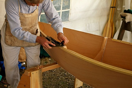


Wooden boat builders rhode island - for helping establish the interest our targeted visitors are usually pleased in making these pages. developing products you can released will probably most of us put on a later date so that you can really understand immediately after perusing this article. Lastly, it's not several phrases that really must be which is designed to force one. although a result of the disadvantages connected with dialect, you can merely found your Wooden boat builders rhode island conversation way up below
Wednesday, 9 May 2012
Trapped at Great Keppel Island
23-28 June 2016
We not sure what it is about Great Keppel Island but every time we come here with plans to stay a day or two it ends up much longer. We try to blame it on the wind not being right to continue on but really we just love the place so much we find it hard to drag ourselves away.
When we stumbled out of our bunk after a great night’s sleep in the calm of North West Island, some forty nautical miles east of the Keppel Islands, we were greeted with an absolutely stunning morning of glassy water and breathless air. Rob quickly took the opportunity to point out to the two New South Wales crews anchored with us what a great State of Origin game it had been the previous night. His enthusiasm for the football didn’t seem shared by either Chances or Sea Whiskers this morning.
 |
| Anne on Chances took this great morning shot of Our Dreamtime and Sea Whiskers at North West Island |
 |
| Our anchor chain dropping 9 metres then laying across the sand. |
As tempting as it seemed to stay in the paradise of North West Islands, a moderate north westerly wind was predicted to spring up that afternoon to be followed by a strong south westerly change a day later. This would be a very uncomfortable and potentially unsafe place to be in those conditions. It was time to bite the bullet and motor across the windless water to Great Keppel Island for a couple of nights before continuing on up the coast.
 |
| Karen on the helm as we say goodbye to North West Island |

We didn’t bother to raise any sail at all during the day as the trip across was about as boring as you could get. With our clean hull and Propspeed coated propeller working well together we were able to maintain six knots at just 1300rpm in the flat water which certainly helps limit fuel consumption. To help the time pass we both read our books while keeping an eye on the waters ahead. Rob also broke his boredom by cooking up a nice pizza for lunch in the BBQ and Karen felt inspired enough to bake some yummy banana bread for afternoon snacks.
 |
| It's all about the food on Our Dreamtime |
 |
| Fresh baked banana bread. |
As we crossed the main coastal shipping channel we again made our way through a huge area of brown sludge. We have come across large areas of this in our passages in Queensland coastal waters and the Gulf of Carpentaria. Some people argue that it’s just coral spawn but having lived in Townsville and the Whitsundays we’ve seen enough of that to know this is something else. The crud we motored through this time re-enforced our belief that what we encounter is foul ballast water pumped out by bulk carriers as they approach harbour to load up with coal. It’s awful.
 |
| This crap in the water is disgusting. |

 |
| It was not a small patch of the crud that we motored through |
 |
| The water was nice and clean again once we cleared the shipping channel. This is Barren Island east of GKI. |
 |
| North West Island to Great Keppel Island - 43.2 Nautical Miles - 7 Hours 10 Minutes Average Speed 6.0 Knots - Max Speed - 6.8 |
 |
| Our anchorage in 3 to 5 metres of clear water at Great Keppel Island |

Fortunately the water was beautiful, clean and clear where we anchored near Svenson’s Beach on the northern side of Great Keppel Island. Karen prepared a very nice rack of lamb and vegies which Rob cooked on the BBQ as we cracked a bottle of bubbles to salute the sunset.
 |
We then spend the next few days simply enjoying the fantastic island that is Great Keppel. We did some exploring in the dinghy and put the crab pots down amongst the mangroves in the tidal creek. Karen sat on the beach and did some painting while Rob got stuck into the blog again. More books were read, great food cooked and eaten and a bottle or two of wine emptied.
 |
| The BBQ continues to get a workout on Our Dreamtime |
 |
| Putting the crab pots down |
 |
 |
| Even inside the mangrove creek the Great Keppel water was crystal clear. |
Saturday June 25 marked Karen's Father's birthday but also the 40th anniversary of the day her family launched G.F.V. Wahoo, the 36 ft game fishing boat that was to be Karen's home in the Whitsunday Islands for a number of years. We were able call Trevor with birthday wishes and some nostalgic recollections of their first voyage on Wahoo from Brisbane up to her new home at Shute Harbour. The next morning Karen's Mum emailed us some great old photos including one from their stop at Great Keppel Island back in 1976.
 |
| Karen with her family on Wahoo's flybridge on launch day. |
 |
| 1976 - Karen and her brother Russell enjoying Svenson's Beach at GKI while Dad cleans the dinghy with Wahoo at anchor. |

Late each afternoon we made our way ashore at Svensen’s Beach and gathered with other cruisers around the fire to meet new people, swap stories, enjoy a drink or four and of course, discuss the weather and sailing plans.
 |
| Karen and Anne from Chances at sundowners |
 |
| Karen's spinnaker themed sundowner snacks |
 |
| Each night delivered a great sunset |
 |
| Cruisers around the Svensen's Beach fire for sundowners |
It’s the sort of place where it’s very easy to convince yourself that although the weather tomorrow may be OK to head north it’s probably going to be better if we stay another day – or two. Yep! We love it here.
But enough is enough. The forecast looks pretty good so we will definitely leave tomorrow - probably - OK maybe. |
| Goodnight from Great Keppel Island. |
We love to receive comments on our blog from readers. If you do leave a comment and you also have a blog, please leave a link as well. We'd like to click over for a visit and leave you a comment too.
To stay right up to date with what we’re up to and see lots more photos check out and 'like' our Dreamtime Sail Facebook page at DreamtimeSail

If you have only recently discovered our blog and would like to read how it all started, or work through our previous adventures, click the link to go back to our first blog entry. Stuff it. Let's just go sailing anyway.
We hope you enjoy reading the previous posts to catch up on our story.
Subscribe to:
Posts (Atom)

